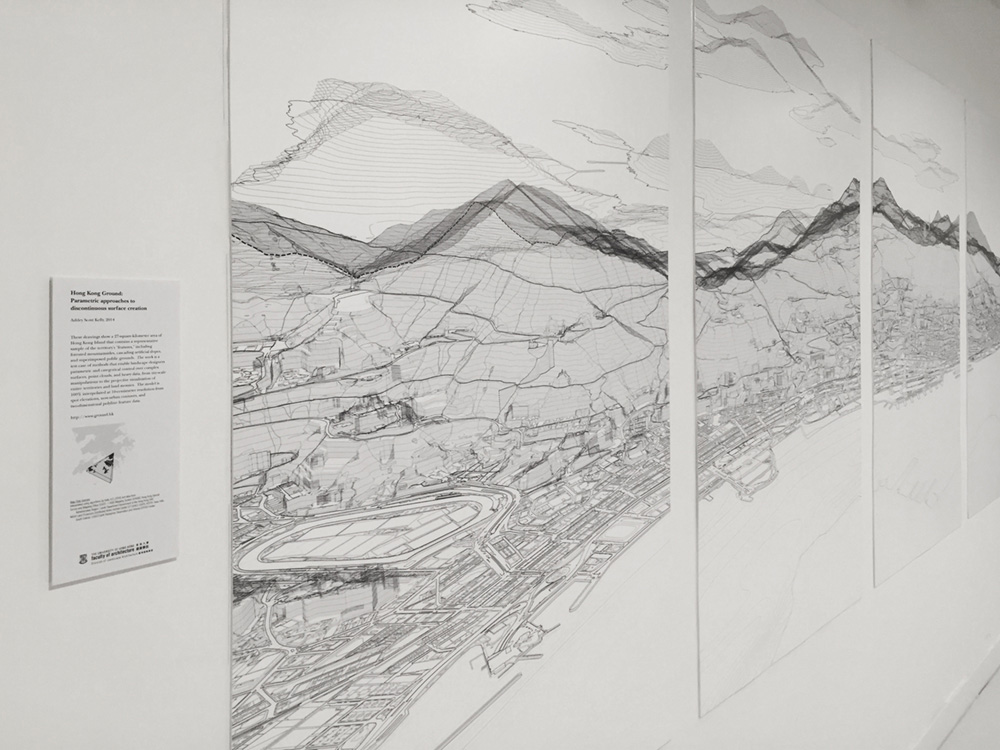
This interactive map showcases methods enabling parametric and categorical control over complex surfaces, point clouds, and heavy data, from site-scale manipulations to the projective visualization of entire territories and land mosaics. The test site is a 27-square-kilometer area of Hong Kong Island that contains a representative sample of the territory's "features," including forested mountainsides, cascading artificial slopes and superimposed public grounds. The model is 100% interpolated from spot elevations, non-urban contours, and two-dimensional feature data.
Background
Hong Kong commissioned a territory-wide LIDAR survey by air in 2010. In Lai's 2012 report[1], classification of "ground" and "non-ground" was found difficult, citing "complex landforms." The paper's noted applications are largely restricted to non-urban areas, likely due to the dense shadowing in the city's streets and alleyways. Hong Kong Ground presents a model of Hong Kong that is not the 1:1 representation of reality that a LIDAR point cloud approaches but instead a model of crisp, infinite lines much closer to the way architects currently conceive, describe and represent their projects. The method uses a 100% procedural and automated workflow to "reverse-engineer" the Lands Department's two-dimensional B1000 tiles into a ten-centimeter-resolution 3D model of the Hong Kong Island ground plane. Production is systematized towards a direct input-to-output relationship, while narrating the difficultly of systemic automation and its limits in a city with such complex physical and cognitive geography.
Application
The work positions tessellated space, and its plethora of tools for manipulation of discontinuous and highly idiosyncratic spatial data, as key to landscape's parametric project. It argues for the use of GIS equally for both regional and site-scale works, with broad implications methodologically and pedagogically for 3D digital spatial design. Given the complexity of Hong Kong's urban topography, one that even limits the most advanced current LIDAR methods, modeling a large section of the ground plane presents innumerable challenges. Resolution, fuzzy logic, and the fragility of this as a design workflow are central tenants of a project that works simultaneously between design and an abstract geostatistical environment.
[1] Lai, A. C., So, A. C., Nga, S. K., & Jonas, D. (2011). The Territory-Wide Airborne Light Detection And Ranging Survey for the Hong Kong Special Administrative Region. Paper presented at the The 33rd Asian Conference on Remote Sensing, Hong Kong.

Served using Leaflet, a JS library for interactive maps.
Posted by: Ashley Scott Kelly (Hong Kong Ground)